Thursday, February 5, 2015

Street Profiles: The History of Tweedsmuir Avenue

This week's street history will be on Tweedsmuir Avenue. Quite a lot has happened on this long street, which has long been the eastern border of Westboro. In this article, we'll explore it's early days as parts of the long-forgotten suburbs "Mansfield Park" and "Springdale Park"; its tie-in the actual Miss Florence Nightingale; the site of one of Ottawa's worst house fires of all-time; a historical look at it's busy intersection at Richmond Road; and more.

Current Street Name: Tweedsmuir Avenue
Former Street Name: was known as "Strathcona Avenue" until 1941 (a portion was also known as "Xavier Avenue" from 1909 to 1917)
First established: 1900
Name meaning: Tweedsmuir was named after John Buchan, first Baron of Tweedsmuir, and Governor General of Canada from 1935 to 1940, who had recently passed away in February 1940 while still serving as Governor General, after suffering a severe head injury when he fell during a stroke at Rideau Hall. 
How named: A Nepean Township Bylaw was passed in September of 1941, changing the names of many streets in Westboro and the suburbs to the east (to eliminate duplication within Ottawa and its suburbs). The Canadian Post Office Department required it do to the commencement of door-to-door mail service. As there was also a Strathcona Avenue in the Pretoria-Glebe area, Westboro's Strathcona was required to change. Many patriotic names were selected (Churchill, Roosevelt, Patricia, etc.) as WWII was raging at the time. A second large-scale street renaming in west Ottawa was later done in 1944.

Early days:
The earliest beginnings of what we now know as Tweedsmuir Avenue can be traced back to the Cowley family. Daniel Keyworth Cowley's farm on Richmond Road was located just west of what is now Island Park Drive during the second half of the 19th century. His son Robert H. Cowley, who was Provincial School Inspector, also grew interested in real estate development. He acquired portions of his parent's property, as well as other parcels of land, and created a series of subdivisions within Kitchissippi during the 1890s and early 1900s. His first foray was the little community of "Ottawa West" which he laid out in 1893, and which grew steadily over the next 10+ years (this is the area between Richmond and Scott, bordered by Western and Rockhurst; more on it in a dedicated future column). In December of 1900, Robert Cowley purchased a three-sevenths interest in a 43 3/4 acre parcel of land owned by Ottawa lawyer Arthur James Forward (he himself had only purchased the land a few months earlier). Forward was a friend to Sir John A. MacDonald and was heavily involved in Ottawa's business and political scene. Perhaps unaccustomed to the world of real estate prospecting, Forward allowed Cowley to become the chief shareholder when he sold an additional two-sevenths interest to Cowley's cousin John McJanet, leaving himself also with two-sevenths interest.

So just before Christmas of 1900, the trio registered Plan 206 with the County of Carleton, laying out both sides of present-day Tweedsmuir Avenue from Carling north to just past Clare Street, both sides of Clare east to what is now Kirkwood, and both sides of what is now Avondale west to Churchill. It was an odd little plan, laid out based on the odd-shaped parcel acquired by Forward. It was particularly odd in that this area was really quite isolated at the time. Some minor growth had occurred just to the west on the old Birch property, and the Hilson development was decent on the east. But at the time, it was largely farmland surrounding it. 

Original Plan 206 creating Tweedsmuir Avenue. Carling Ave
is at left, Churchill along the top. Clare is at bottom right.
Before we jump into the birth of Tweedsmuir Avenue, it is worthwhile to look back at this 43-acre parcel of land, and the period of time just a little before Forward and Cowley acquired it. This piece of land was owned in the 1870s and 1880s by Senator Hon James Skead, who owned a mill where Westboro Beach now exists. He also accumulated as much land in Kitchissippi as he could get his hands on. But hard times later hit Skead, and he lost a lot of his land to the banks. After his passing in 1884, his widow Rosina sold off his remaining holdings. In May of 1891, Rosina sold this particular piece of vacant farmland to Charlotte and William Upton. 

The Uptons were notable Gloucester Township pioneers. William was born in 1811 in England, and his family had relocated to Russia some years afterwards. William’s father John Upton had helped build Sevastopol, Russia, including the water supply, road layout and many features of the town and harbour. After the Crimean War, the family immigrated to Canada in 1857, and built a homestead (known as “Groveland”) over where the Ottawa Hunt Club and part of the Uplands airport is now located. William Upton is also well recognized in local Ottawa history owing to his detailed diaries of life on his early Gloucester farm, all of which have survived (and are an incredible read, if you can access sources to it - some harrowing tales of grim, lonely, cold winters in the mid-19th century). 


Ottawa Citizen - February 22, 1938
The Uptons never did anything with their Westboro land, and in fact both had passed away within three years of acquiring it. But what makes them notable to the story of Tweedsmuir Avenue is that they were friends of THE original Florence Nightingale (who is perhaps best known for her work tending to soldiers during the aforementioned Crimean War, creating a legacy of changing the nursing profession to a more compassionate, committed style of patient care).

An article was written in the Ottawa Citizen in 1938 about the Upton's daughter (who led quite an interesting life!) and was still alive at the time, at 92 years old. Notably, the article describes the Uptons connection to Miss Nightingale, and thus proves the Westboro link; that friends of Florence Nightingale indeed owned a good portion of pre-developed Westboro in the 1890s!

So back to Tweedsmuir Avenue - the street originally was given the name "Strathcona Avenue", after Sir Donald A. Smith, knighted in 1886 in honour of his executive role in the development of the Canadian Pacific Railway, and was titled Baron of Strathcona and Mount-Royal. He also served as Canadian Commissioner in London from 1896 until his death in 1914 at age 94. He was best known for driving the “Last Spike” on the CPR in 1885 at Craigellachie. 

Most lots on Strathcona were about one-half acre apiece (100' x 200') in size. It was still unforeseen that west-end neighbourhoods would become as packed with homes as they are now. Over time, these large lots would be split quarters or smaller sized parcels of land. The depth of these lots was incredible though - the ones on the east side stretched all the way back to (and early on included) the hydro right-of-way. 

The first lots sold on Strathcona were sold to Samuel Bruce Edey in early 1901, who purchased a block of 4 lots (lots 5, 6, 7, and 8) on the east side of the street (this would now encompass the area from about 679 Tweedsmuir south to where the street turns into a dead-end at Saigon Court. 

681 Tweedsmuir in 2014; the first
house built on Tweedsmuir
Edey built a small home just a little north of where Currell now runs, on lots 7/8. Impressively, this house has survived, and is now the original core portion of the expanded home at 681 Tweedsmuir.

Samuel Edey's family (well,
everyone except him - the
photo shows his parents, his
wife Miriam, and their 2 kids)
(source: Ancestry)
Edey was from the Carp area, and had moved to Westboro in 1899 after marrying his wife, the impressively-named Araminta Miriam Hawkshaw. Samuel worked as a market gardener, likely utilizing the fertile gardens and orchards found on his large property. Miriam's father William Hawkshaw even purchased a lot of his own (lot 13) on Strathcona, perhaps intending to one day move as well, but he never did, and the lot was resold back to Cowley, Forward and McJanet a few years later.

The Edeys did not remain on Tweedsmuir for long, as the family left Westboro by early 1906, returning back to the family homestead at Marchhurst. Their little home (valued just $150 on the 1905 assessment roll) sat vacant for several years, before eventually being purchased and improved by its various owners throughout the early part of the century. 

The Edey house, and the vastness of the area can be best shown in a 1920 aerial photograph of the area (see below):


1920 aerial photo of the intersection of Tweedsmuir (running top to bottom)
and Carling Avenue (running left to right along bottom edge). Not much to
the area in 1920. The Edey house is visible near the top. Currell Avenue can
be seen running west off Tweedsmuir, with a small cluser of houses at it's
southwest corner. Carling Avenue has barely any construction at all).


The second home built on Strathcona was constructed between 1904 and 1905 by Joseph Breadner on lot 19 (it no longer exists, but was built about where 232 Clare Street now stands). The next oldest house built and still standing from these early days is 569 Tweedsmuir, built by William F. Turner in 1910.

 
North of the new Strathcona Ave development was the James Magee farm. Magee was the son of one of Richmond Road's earliest settlers, Charles and Francis Magee having opened their farm on the south side of Richmond Road in the 1840s. James Magee spent his working life as a farmer, cattle dealer and cattle “drover” (a person who moves cattle over long distances). He housed his cattle during the late 1800s on other property he owned north of Scott Street, over the former site of Skead’s Mill (now Westboro Beach). 

Ottawa Journal,
July 20, 1909.
By 1909, Magee had retired from farming, and was ready to take advatange of the popularity of the area. He filed a plan in May which he titled "Springdale Park", which encompassed Tweedsmuir and Athlone from Richmond Road to north of Clare. The name "Springdale Park" was selected mostly for advertising reasons, and did not stick. Largely this segment of Tweedsmuir was simply known for years as the Magee Farm. Magee used Strathcona for the continuation of the street north, but for the new street Athlone, he chose the name "Magee Street". 

This interweaving of the two subdivisions also explains the slight jog Tweedsmuir takes north of Clare; it is where the two streets met up, though slightly out of line. But where the jog begins is where the Magee farm ended.


405 Tweedsmuir - RIP
The first house built on this segment of Tweedsmuir was #417, built by contractor John A. Parker in the summer of 1911. It remains today. Just down the block at #405 was an impressive brick home built within a year of #417. I was sad to see this house town down in 2012 to make way for the new development that has been built in its place on the sizeable lot behind the Richmond Plaza. At right is a photo of it during its final days.

The last segment of Tweedsmuir Avenue is the portion north of Richmond Road. This was a small subdivision created by Francis Xavier Laderoute, an Ottawa real estate agent and speculator. In March of 1909, Laderoute subdivided a 12-acre of parcel of land formerly part of Frederick Heney's holdings. He called his subdivision "Mansfield Park", and created two streets between Scott and Richmond Road (Athlone and Tweedsmuir), which he called, respectively, Francis Avenue and Xavier Avenue. This was Carleton County Plan 263. 


Ottawa Journal - March 27, 1909
Plan 263 was officially filed on March 27th, and already by April 30th, there were several lots that had been sold, and construction begun on 3 houses. The first homes built on Xavier (Twedsmuir) north of Richmond Road were on lot 9 (was 369 Tweedsmuir, now torn down, owned and built by Thomas L. Goode, a contractor), lot 15 (345 Tweedsmuir, owned/built by William H. Pack, a blacksmith and carpenter), and lot 42 (372 Tweedsmuir, owned/built by Samuel J. Hunt, contractor).

Laderoute took out some ingenious ads in the local papers, looking to separate himself from the other agents selling lots in all the other growing mini-subdivisions in west Ottawa at the time. Very persuasive ads indeed!

Following the success of his “Mansfield Park” project, Laderoute would create and sell lots in several other subdivisions in the area, and “Laderoute Avenue” running between Iona and Clare just next to Kirkwood still bears his name today.  

It was around this time as well (summer of 1909) that the ratepayers of the area decided to create a new district, and the name "Laurentian View" was chosen. This was a well-used name throughout the 20th century, but oddly disappeared in common usage by the late 70s. The center of Tweedsmuir was the western boundary (Hilson was the east), and it covered the area south of Richmond to Carling. Thus, from 1909 until 1950 (when the area became part of the City of Ottawa), Tweedsmuir was split between two different districts: the west half belonging to Westboro, the east half to Laurentian View


Businesses on Tweedsmuir Avenue: Tweedsmuir has not always been necessarily strictly residential. A quick glance through various archival sources shows that over time a few businesses have existed on Tweedsmuir itself, not to mention at the corners of the main intersections of Richmond Road and Scott Street. Let's start with a look at the intersection of Richmond and Tweedsmuir:

NW corner: Now Whispers (the subject of a soon-forthcoming blog post of it's own, so I won't go too deeply in to details!). Was built in 1911 as a home, Later became altered to allow for a small grocers shop and convenience store in the 1920s. Best known as the "Westboro Confectionery" for 25 years (run by George Monsour). Later a restaurant, and became Whispers in 1981.

NE corner: Was Junipers until recently. Sat as a vacant lot until the fall of 1952 when Gale's Used Cars operated out of a small building at the back of the lot, alongside Tweedsmuir. The car shop changed hands a couple of times (Hollington & Hobbs in 1957, Elliott Motors & Trailer Sales in 1963, Alan Auto Sales in 1968), before Otto's moved from Carling Avenue and built a large showroom in June of 1969. Juniper moved into the west portion of the building around 2006.

1920 aerial photograph of Tweedsmuir (running top to bottom)
and Richmond Road (running from left to right)
(Click on the photo, or any photo to enlarge it). The aerial photo at left shows the intersection of Tweedsmuir and Richmond Road as it was in 1920. Whispers is there (the large white-looking box at the corner), and Tweedsmuir itself is barely a lane north of Richmond, and even less than that south of Richmond to Byron. Sparsely built on at the time as well. Kitty-corner to Whispers one can see the original home where Nick's Service Station now exists, owned by the United Church.


SW corner: Is Mac's Milk now, formerly known as Winks (where the back part of the store was a huge wall of VHS movie rentals, from which my Dad used to rent videos all the time; only 99 cents in the early 90s!). There was originally a house here, torn down in 1952, and replaced by a Sunoco station in 1953 (operated by different managers including John B. Brown, Stu McGarvey, and Burns). In 1970, the original station was essentially demolished and replaced with the new building when it became Taylor's Sunoco. Sunoco closed in the mid-80s and was replaced by Wink's.


SE corner: About to be redeveloped, but was Nick's Service Station, plus the Richmond Plaza Motel of course. Was owned as a huge private lot by the United Church, with a house for the Reverend, until it was sold in 1950. The house stayed until about 1956, when the lot was redeveloped, and the Richmond Plaza Motel opened around 1957. Fronting Richmond was the service station which opened as Elliott's B.P. Station, also around 1957, until later becoming Nick's B.P. in the early 70s. (I assume Elliott's here was tied to the Elliott's used car lot which existed across the street and mentioned above).

Intersection of Richmond and Tweedsmuir in 1965.
Whispers at top left, the used car lot top right, the Sunoco
bottom left and the BP station bottom right. At the very
bottom right can be seen the north edge of the Richmond
Plaza, and a few cars parked diagonally in front of it.

The intersection of Scott and Tweedsmuir is a little less interesting. The southeast corner had a large home on it until the early 70s before it was demolished and the lot left vacant (I think Trailhead keeps a little outdoor shed on this spot now). The southwest corner is now a short building used by Adam's Moving Company, which has been on Scott Street since the mid-70s. It was built around 1952, and has been used by many companies over the years: Hart Construction (1952-1954), WT Sharp Flooring (mid-50s), Seaway Building Specialties (late 50s), FJ Shouldice Construction (most of the 1960s), Rideau Electric (late 60s), Alpine Roofing (late 70s), and others.

Otherwise, over time the little subdivisions blurred into one single neighbourhood, and Tweedsmuir evolved into one single street (with a single name to boot). Construction on the street was gradual, but was largely built up by the mid-40s. Considerable expansion was seen with the development of  the 21 rowhouses at 674 Tweedsmuir (purchased by the City of Ottawa Non-Profit Housing Corp for $607,000), and also by the development of the large area in behind Tweedsmuir (Molenaar Pvt) by the Westboro Housing Co-Operative in the early 1980s (phase III to their original plan of creating affordable housing in the Westboro area; phase I was the renovation of 19 existing homes and apartments; phase II, completed in 1980, was 10 townhouse units at the end of Elmgrove Avenue).

Notable Events:
The front cover of the Ottawa Journal - January 12, 1956
Tweedsmuir Avenue was the site of one of the worst house fires in Ottawa history. On January 12th, 1956, a fire at 321 Tweedsmuir killed a housewife and three of her six children. What made the story even more shocking was that her husband, former Ottawa Rough Rider Curly Moynahan, was a Lieutenant with the Ottawa Fire Department. And even more shocking than that was the fact that Curly Moynahan was out of town in London, Ontario at the time, acting as a pall-bearer for her five-year-old niece Susan Cadieux, who had been assaulted and murdered a week earlier (that horrible case was never solved). 

The fire at 321 Tweedsmuir started in a back bedroom during the night. An alert neighbour managed to save 17-year-old daughter Diane and 18-month old baby Ricky by placing a ladder against the front of the house.  

Lost in the fire was Mrs. Joan Moynahan (39) and her three daughters Maureen (11), Sandra (6) and Joanne (4). 

Ottawa Journal photograph - January 12 1956
Curly Moynahan rebuilt the house after the fire and the remaining family lived in the new home for many years following.

So this concludes my look at Tweedsmuir Avenue. I could keep going, but I have to stop somewhere! As mentioned above, please look forward to my more in-depth look at the neat history of the Whispers Restaurant building, coming up later in February. Cheers!

Wednesday, January 28, 2015

Stirling Avenue - an addendum

Wow, well I can't believe how popular the History of Stirling Avenue blog post was. Thanks to everyone for the great comments and input. It really excites me to keep this blog going, and to start up the next street history. (If anyone has any street requests, by all means post a comment or shoot me an email - no sense in waiting for months or years for me to finally get to your street, if you're particularly keen about reading about it!!)

So in the post, I mentioned how I sadly had yet to come across a photo of the Stirling Tavern in it's glory years. As luck would have it, I had an awesome reader come through and send me a tip on who to speak to who had a photo. So a huge thanks to Emma Robe for linking me up with Ray Sullivan, who so kindly shared with me some stories and photos of the Stirling Tavern in the early 90s. I was really excited to see that one of the photos was a nice, large photo of that unforgettable Stirling Tavern sign - ideal for a t-shirt, wouldn't you agree Andrew King? :)

Enjoy the photos...


Photo courtesy of the CCOC

Photo courtesy of the CCOC

Photo courtesy of CSV Architects


The Victoria Theatre: Wellington Village's place to be in the 1930s and 40s

Many of us in Kitchissippi still have memories of the good old days of the Elmdale Theatre. In some ways it seems crazy that it has been now more than twenty years since it closed in 1994, unable to compete in the fast-moving and changing business of movies, with huge megaplexes, constantly evolving technology and a greater demand on overall movie-going experience. The little two-screen Elmdale at the corner of Wellington and Hamilton just couldn't keep up. Nor could any of its companions like the Somerset and Elgin. And it really is unfortunate that it could not. The youths of Kitchissippi today will likely now never experience going to a movie in this neighbourhood; an experience now requiring a long bus ride west (to the Coliseum), south (South Keys) or east (Silver City) to take a date and see a movie. Even all the downtown theatres are closed. A tragedy. At least we at least still have the Elmdale Theatre building to look at (or maybe not, after all it is a daily constant reminder of what we've lost).

But besides the Elmdale (which I'll surely cover some day more extensively on this blog), I wanted to briefly talk about a different movie theatre which I'd bet 99.9% of Kitchissippians don't ever know existed, and equally would be hard-pressed to even try to picture where it once stood for nearly 40 years.

In the early 1930s, Wellington Village was exploding. The Ottawa Land Association had finally sold off all the lots in the early 20s (after sitting on the land for 30 years) and the roaring 20s saw a huge boom in construction on streets on both sides of Wellington West. Even the depression did not slow development too much, and by the 1930s, there was a great movement afoot for commercial interests to move in to the area and take advantage of a lack of infrastructure such as shopping, grocery stores and most notably, entertainment.

Aerial photo from May 5, 1933 of Wellington Street.
Huron on the right, Caroline on the left.
Hintonburg had a theatre since 1914 at 1045 Wellington Street (now an empty lot next to the Wellington Towers apartment building across from the St. Francois D'Assise Church), but west of this theatre, there was nothing. So in the summer of 1934, construction of a new movie theatre began on a large empty lot on the north side of Wellington Street, between Huron and Caroline. 

The 800-seat theatre was built by a business called the "Wellington Amusement Company", at a cost of around $38,000. The general contractors for the job were a little-known Ottawa business, the Ottawa Construction Company (president Edgar Proulx). Walls, tiling, ceramic floors and steel windows were supplied by the F.H. Emra Company, specifically highlighting their use of haydite, a lightweight concrete, for "perfect sound" and acoustics. The seats installed were the Interior Hardwood Company's patented "Self-Tilt Theatre Chairs, which are roomy, comfortable", and were equipped with the Dunlop Tire and Rubber Goods Company's "Dunlopillo" cushioned seats "which mould themselves to your figure" and "never heats, as each unit is self-ventilated. As soon as it is released from weight, it springs back to normal shape." 

Construction details of the Victoria Theatre: Ottawa Journal December 1, 1934

The grand opening was held on Saturday December 1st, 1934 with 4 showings of the movies "The Thin Man" and "Evergreen" at 12:30, 3:00, 7:00 and 9:00.  

Programming consisted of two changes weekly of double-feature programs. The prices weren't too bad either: Admission to matinees on Saturdays and holidays were 10 cents for children and 15 cents for adults; while for evening performances, of which there were two each night, at 7 and 9 p.m., was 25 cents for adults.

The Ottawa newspaper at the time related the importance of the theatre: "As a theatre has become an essential feature in neighborhood community life it is natural that the West End merchants are keenly interested in the success of the "Victoria" which is a welcome addition to the social life of one of Ottawa's most progressive districts". 

The Victoria Theatre (photo from the Ottawa Journal, December 1 1934)

The Victoria was indeed an instant success in the community. So much so that within less than a year, already the community association and politicians were concerned about parking issues which had developed along Wellington Street. The obvious solution of course: ban parking on Wellington Street! I don't know how they resolved the issue, but this was merely a blip in a successful start-up of the local business.

Somewhat oddly, only four months after opening, the Wellington Amusement Company sold the theatre to well-known Hull-based theatre operator Donat Paquin for $40,000. Paquin would be the one to run the theatre for the next 13 years, the golden years of Wellington Village's development.

The Victoria Theatre - National Archives photo C80423, and borrowed from
Alain Miguelez's incredible book "A Theatre Near You". Thyme & Again's
building can be seen in the background at right.

Ottawa Citizen - August 14 1936

In August of 1936, The Victoria showed "Charlie Chan's Secret" starring Rosina Lawrence, who spent her childhood years on Wilmont Avenue in Westboro before moving to Hollywood and starring in several major movies.


Below is a really cool fire insurance plan view from 1948, showing the block between Caroline and Huron: the Royal Bank (now Flock Boutique), Loblaw Groceteria (now St. Vincent De Paul), the Century Theatre (now the large apartment building), and Higman's Hardware & Paint Shop (now Thyme & Again).
Goad's Fire Insurance Plan from 1948 

Aerial photo from 1965, showing the theatre in use as a car dealership
The Victoria would later be purchased by Twentieth Century Theatres in 1947, and would be renovated (with air conditioning) and reopened as the Century Theatre in 1948, to compete with the Elmdale Theatre (which had opened across the street in 1947). It lost out, and after a brief stint as the "Towne Cinema" from 1954-55, sat vacant for two years (it was considered an option to deal with the overcrowding of Fisher Park High School in 1956), re-opened as the Towne briefly during the winter of 1957-58, was a temporary lodging site of the Parkdale Baptist Church during renovations in 1958, and finally re-emerged as a car dealership and service centre in December of 1958 (Paul Cardinal Ltd., dealer of Austin cars). Cardinals would remain open until 1969, replaced by Jack Samuels Garage for a few years, until it was torn down around 1975, and replaced with the apartment building which is still on this spot today.

Ottawa Journal - December 30, 1952

I hope you enjoyed this article, and maybe you'll view this spot on Wellington a little differently now! I've only really covered the basic history of the theatre. For more information, a more comprehensive history of the theatre is covered excellently in a great book written by local Ottawa historian and movie theatre expert Alain Miguelez, "A Theatre Near You". If you have not seen this book yet, I encourage you to seek it out.  Easily one of my 3 favorite books I own. It is nearly 400 pages of well-researched and wonderfully-described stories and details of every theatre in Ottawa's history. More photographs than you can imagine, and you can tell he has put his soul into this book. There are 4 pages on the Victoria Theatre alone. 


Sunday, January 25, 2015

Street Profiles: The history of Fraser Avenue

This week I am looking at the history of Fraser Avenue which is in the McKellar Park-Westboro area of Kitchissippi. This is a street which may have a lot more history in it than you can imagine. Part of this street was once a golf course. All of it was once a farm. Street cars ran through it for 60 years. It was the site of a deadly train wreck of new Canadian immigrants. And most importantly, like the neighbourhood which surrounds it, the street has developed into a place that families can call home for many years. Many move on to Fraser and remain for multiple generations.

Current Street Name: Fraser Avenue
Former Street Name: was known as "First Avenue" until 1944 (and part of it as "Banting Avenue" from 1950 until the late 50s)
First established: 1911
Name meaning: Was named after Robert and Mary Ann Fraser, one of the first (and long-time) builders and residents of the street. Their home (551 Fraser Avenue) remains standing today as a McKellar Park landmark.
How named: Nepean Township worked with the Canadian Post Office Department in 1944 to established improved addressing for the introduction of mail delivery in the suburbs. As a result, large-scale home renumbering and street renaming took place. At this time it was also known that annexation of Westboro to the City of Ottawa was imminent, thus a Bylaw was passed in April of 1944, changing the names of many streets in Kitchissippi. The large majority of streets were given new patriotic names. All of the numbered streets in the McKellar Townsite subdivision were assigned proper names, in some cases recognizing long-time, pioneering families of the suburb. Fraser Avenue was one of these streets named to memorialize the important and well-loved Fraser family.

Early days:
The McKellar Park neighbourhood, of which Fraser Avenue is the original/historic eastern border, has it's earliest roots dating back to 1873, when 60-year old dairy farmer Archibald McKellar purchased 266 acres of land in west Kitchissippi. McKellar was born in Scotland, and had come to Canada just shy of his 30th birthday. He had established a successful dairy farm on leased land on the Billings Estate in the east end for the previous 30 years; the Kitchissippi purchase was his first instance of owning property. The McKellar's new farm had already been in existence for many years, dating back to the Thomson family (they of the Maplelawn-Keg Manor fame). Along with acquiring the land, McKellar purchased the large stone mansion on the north side of Richmond Road (built circa 1840). He modified the home a little, but ultimately it looked the same in the 19th century as it still does now (on Richmond Road, near the foot of Windermere Avenue, better known as McKellar-Bingham House).

Below is an amazing illustration of the farm from Belden's 1879 Atlas of Carleton County. So many details! From the train (on which was then the Canada Central Railway line), the buggies on dusty Richmond Road, the square timber raft, etc.

McKellar farm from the 1879 Belden Atlas. Note the stone mansion house at
the top left which still stands on Richmond Road today.

Archibald McKellar passed away in 1889, and willed the farm to his only son, John McKellar, who was 45 years old at the time. John and his two sisters still resided at home, and all three were unmarried (I suppose the options for courting and marriage in this era were very limited, particularly on the relatively isolated farm). John McKellar and his sisters kept the farm going for another 22 years.

"Drawing Hay at McKellar Farm" photo from the Topley Collection at
the National Archives (PA-009866). This photo would date from the 1890s,
and shows the Ottawa River in the background top left, the Thomson farm
and Maplelawn top right, and the cluster of trees lining Richmond Road.
In 1899, McKellar sold a portion of his farm land to the Ottawa Electric Railway, who were extending streetcar out to Britannia. The rail line split the McKellar farm near the north end when it ran its first trial run car on December 18th, 1899. Regular streetcar service began on May 24th, 1900, and would run until May of 1959.

1911 was a huge year in the transformation of McKellar Farm. A local group of businessmen, led by coal dealer Gordon F. Hodgins, had formed a syndicate and came to an agreement to purchase the farm sometime in late 1910. It was officially registered in the spring of 1911, but the group (the McKellar Townsite Company) wasted no time in drawing up a plan for the community, and kicking off an aggressive advertising campaign in the newspapers of Ottawa. Advertisements for lot sales began to run in mid-January of 1911, and the McKellar Townsite Plan (plan M-29) was officially registered with Carleton County on June 14th, 1911. The plan created 1,029 lots in McKellar Townsite on seven new streets running north-to-south from the River to Carling Avenue. The Townsite Company hoped to cash in on John Cole’s recent success in selling real estate in Westboro and Highland Park. The company graded the roads and in 1912 installed 24,000 feet of cement sidewalks. The lots were equipped with electric light and heating, and water was sourced from artesian wells (where pressurized water naturally rises to the surface). The company also opened a quarry on the property and supplied building stone at cost to lot purchasers.

Earliest map of the McKellar Townsite plan from January of 1911. After realizing
the confusion that would likely result from duplicate naming of streets with
"Avenue" for north-south and "Street" for east-west, all of the east-west running
Streets would be given proper names in the final plan filed in June of 1911.
The future Fraser Avenue appears here as "First Avenue" at the top.
The initial promotional campaign for lot sales was intense, and the managing director hired to sell the lots, W. H. Tate, was creative in his two-plus years of advertising. A sample of some of the original ads appear below (click on these or any photo to bring up a slideshow which enlarges the photos):
Ottawa Citizen, March 10th, 1911
Ottawa Citizen, May 4th, 1912
McKellar himself had no involvement with the McKellar Townsite Company. He sold the land but kept two lots as his own, on which stood (and still stands) his historic stone mansion, as well as a second stone home built during the 19th century. McKellar moved into the smaller home (later known as the "Wayside Inn"), and sold the mansion in 1911 to John Bingham, Managing Director of the Ottawa Dairy Company (and thus is why the home is now known as the McKellar-Bingham House). McKellar died just three short years later, but in that brief time span was able to witness the fast development of the subdivision which bore his name, on the land he and his father had farmed for the past 40 years.

371 Fraser - the first officially built on the street
But back to Fraser Avenue (or First Avenue, as it was known then), The first lot sold in the entire McKellar Townsite was on First Avenue, lot 38 (now the site of 543 Fraser Avenue), sold to Mrs. Margaret MacLeod for the sale price of $400. However, the lot would not be built on until the 1950s. The first structure to be built on First Avenue itself was constructed in late 1912 or early 1913 at the very north end of the street at the water's edge, by Harold W. Jones, Chief Tidal and Current Surveyor with the federal government. This house, 371 Fraser Avenue remained until expropriation in the 1950s. Bob Grainger in one of his excellent columns in the Kitchissippi Times describes the house in greater detail, and I've borrowed a photograph of it from his column at right.

However, on a technicality, this is not really be the first built home on Fraser Avenue. The small portion of the street north of the CPR tracks near the River actually became it's own individual street over time, and in 1950, this portion was renamed Banting Avenue. Bob Grainger does a thorough job in covering the history of that portion in 3 columns at the Kitchissippi Times which I recommend you check out (http://kitchissippi.com/banting-avenuethe-street-that-time-erased/). This little segment is best identified in the little map below taken from the article (note the map does contain one error, as the "Fraser Avenue" line is identified incorrectly. Fraser is the road just to the left. But the map still does the job to show the Banting separation well).


This area north of the CPR tracks would be expropriated in the 1950s anyhow, for the creation of the River Parkway. So unfortunately, this segment of the street has disappeared and with it, all of its stately riverside homes that once existed here.

Ottawa Journal - June 7, 1913
For the Fraser Avenue which still remains today, the first two homes built are both still standing in 2015. They were built at roughly the same time: 551 and 623 Fraser. Construction on #623 commenced in June of 1913 by millwright Percy Ellis Harris. The Journal even made mention of it in their short column on the Townsite (along with the even more notable mention of the pending arrival of telephone lines to McKellar residents!).

Meanwhile, in July of 1913, Robert and Mary Ann Fraser purchased lot 40, took out a mortgage for $2,000, and began building what would become #551 Fraser Avenue.

623 Fraser is pictured at left, a gorgeous shot of this historic Fraser Avenue home in the 1930s.

The building restrictions of the time are quite interesting. Subdivision owners would often include them as part of a sale deed, to ensure only a certain class of home and occupant would reside in the subdivision. The McKellar Townsite Company had a lengthy list of restrictions: "Only one single or semi-detached house to be erected or constructed on each lot according to present survey. Each house must be constructed of brick, brick veneer, stone cement, or if frame, must be clapboarded and painted on outside. All buildings must have stone or cement foundations. No building to be less than 1 ½ stories in height. No business to be carried on upon the land hereby transferred which shall be a nuisance to the neighbourhood, or which will depreciate the value of the property in the vicinity. And any building erected upon the land hereby transferred at any time prior to the first day of January, A.D. 1925 must be of the value of at least Two Thousand Dollars ($2000.00) exclusive of out-buildings when complete, and all water-closets erected upon the said lands hereby transferred must be enclosed in a wood shed or other shed or building, and under no conditions shall any such water closet be exposed to public view. Each building shall be at least twelve feet from the street which it faces. No signs allowed on the within mentioned property without the written permission of the Company."

This era cannot be discussed without including a note on the tragedy which occurred on June 25th, 1913, when a long west-bound C.P.R. Express train headed to Winnipeg filled mostly with new immigrants from Scotland and Ireland, who arrived in Montreal from Glasgow that very morning, derailed, killing 11 and injuring 40. The derailment occurred within a few feet of Fraser Avenue, by the River's Edge.


It is uncertain whether 551 or 623 Fraser was completed first, but certainly by early 1914, both houses were occupied. 555 Fraser next door to 551 was not far behind either.

551 Fraser, the original Fraser family home, pictured at left.

Builder Percy Harris resided in 623 Fraser for a few years before selling to William A. Bond, patriarch of the long-running Bond's Decor business, in 1918. The Bond family would remain in this home until 1957. The Frasers (at 551 Fraser) would go on to raise their four children in the home. Robert passed away suddenly in 1936, while the family was temporarily living in Alberta. His widow and children returned to the house and remained until September of 1943 when they moved for good. As an obvious show of respect, when the streets of McKellar Park were all required to be renamed in 1944, the name "Fraser Avenue" was selected for the former First Avenue.

Overall the street was fairly slow to develop. It was not until post-WWII that the construction boom took off. By 1948, the streets of McKellar Park were still quite sparsely populated. A quick snapshot of the area from the 1948 Fire Insurance plan, showing the area behind Nepean High School between Crossfield and Keenan show Westminster, Mansfield, Fraser and Denbury still with lots of room to grow.

Goad's Fire Insurance Plan of Ottawa 1948

Businesses on Fraser Avenue:

Ottawa Journal - June 11, 1927
Unlike a lot of streets in Kitchissippi, where a corner store or shop frequently would open to serve nearby residents, there appears to have never been a merchant operating on Fraser Avenue over the years. However, one "business" that operated for many years which obviously must be mentioned in this article is the McKellar Park Golf Club.

The Club opened in the summer of 1927. It was an 18-hole, 6086-yard club, which would have present-day outer boundaries of Carling Avenue on the south, Courtenay Avenue on the west, Keenan Avenue on the north and Fraser Avenue on the east.

The course began just next to the Bond's home at 623, with the green of the first hole located mere feet from the house. Tom Unsworth Sr. and Jr. were the course caretakers, and lived in a home on Fraser just north of Dovercourt, which was built around 1932 (633 Fraser).

For more info on the course, Flagstick Magazine in 1998 did an excellent story on its history. I recommend you click here and take a read!: http://content.yudu.com/Library/Az6cm/FlagstickGolfMagazin/resources/47.htm

I've incorporated the map from the story below, which shows well the location of the course (as well, if you take another look at the photo I posted the other day of the barren fields at the intersection of Broadview and Carling, you can now place a golf course on this spot once the snow dries up).

McKellar Golf Course layout (from Flagstick Magazine). Fraser Avenue is
labelled just at the top of the map, running top to bottom. The green for the
first hole is just north of the intersection of Dovercourt, and the greenskeeper's
house, as well as the 3rd hole, is labelled as being just south of Dovercourt.
Sadly, in 1952, a decision was made by the City of Ottawa, and its city council, led by Mayor Charlotte Whitton (the new owners of the McKellar Park Golf Club following the recent annexation from Nepean), that the city of Ottawa would not operate a municipal golf club, and that the land was too valuable. The course was last played on in 1952, and though there was a great call from the golfing community to keep the club open in 1953, even into the spring of 1953, the city closed the course, and soon after sold off the property for housing development later that year. Fraser Avenue south of Dovercourt was very quickly built up with homes within a few short years.

To close off this look at Fraser Avenue, I am sharing a couple of amazing photos which were so graciously shared with me a while back from the family albums of the Bond family. Mr. George Bond, one of the friendliest gentleman I've ever met, and a true McKellar Park historian, had these two great photos showing the McKellar Park subdivision in its infancy, I have yet to see a photo like it, showing what is now such a full and mature neighbourhood, nearly 100 years ago. Mr. Bond estimates the photos were from when the family first moved onto the street in 1918. Given the minimal growth to date, that date would be pretty close.

This is Mrs. Bond and her brother, sitting on the porch at 623 Fraser.
The photo is looking north up the street.

This photo was also taken from the front porch of 623 Fraser, and shows the
McKellar Park subdivision looking west. The Warren home (599 Mansfield)
can be seen at right, and a home on Westminster in the distance at left.


Wednesday, January 21, 2015

The middle of nowhere: Carling at Broadview

A classic photo from about 1952. I don't know why someone took this photo, but I'm glad they did.

(click on the photo to enlarge)

(CA-3246 Ottawa Archives)

Tuesday, January 20, 2015

The eerie past life of the Ottawa Bagelshop!

The Ottawa Bagelshop on Wellington Street is a Wellington Village institution. Growing up in the area (on Gilchrist Avenue), this was one of my family's main shopping spots during the 1980s, when Wellington West was not at all what it is today. I particularly remember Sunday mornings, when it was the only place that would be open east of Westboro and west of Holland Avenue. It was perfect for a kid who wanted to get a newspaper to view the hockey statistics and scores from Saturday night's games (the newspaper used to be the only way to do this, pre-internet!), or when my parents wanted hot bagels for Sunday breakfast. The Bagelshop was (and still is) the place to go.

It opened in April of 1984 when Vince Piazza opened the shop selling "Montreal style bagels" after learning the trade at his brother-in-law's St. Viateur Street store in Montreal. It was in 1996 that the shop expanded to the neighbouring building, which previously had been the Ottawa Church of God and (along with the Peace Finders Gift Shop inside the front lobby). The two buildings had actually been completely separate before, and the renovation connected the two buildings, making it appear as one complete structure.

So the eerie past life of the Bagelshop resides in this "new" part of the Bagelshop (the restaurant portion). You might be surprised to know that for 45 years, this building was a funeral home! 

The Radmore Stewart Funeral Home opened in 1930 in the main floor of a large home built in 1922. It was around this time that the way funerals were organized changed. Prior to the 1920s, it was common practice that when a family member passed away, the post-death care, funeral and wake services were all performed within the family home. It wasn't until after WWI, when the process of embalming was popularized for soldiers being returned home for burial, that the bodies of the recently deceased were moved into funeral homes shortly after death. 

George Radmore Stewart saw a need for a funeral home in the west end, and opened his small business in a converted house at what was then 1323 Wellington Street.

The photo below shows the building as it was in 1943. If you take a good look from across the street, you can still see the loft windows looking quite the same.
The original Radmore Stewart Funeral Home as it looked
from 1930 until 1947

Aerial photo May 1933 
At left is an aerial photo of Wellington Street between Ross (at left) and Grange (at right) from May 1933. The funeral home is at the corner of Grange, and you can see the original addition as well (now the Strawberry Blonde bakery), which was an auto
garage at the time. The main Bagelshop building would later be built in the adjoining vacant space, and the next building to the west is the Gastropub building (built 1923). Across the street, where the Parma Ravioli now exists is a big "V" which was likely a large-sized advertising billboard. 


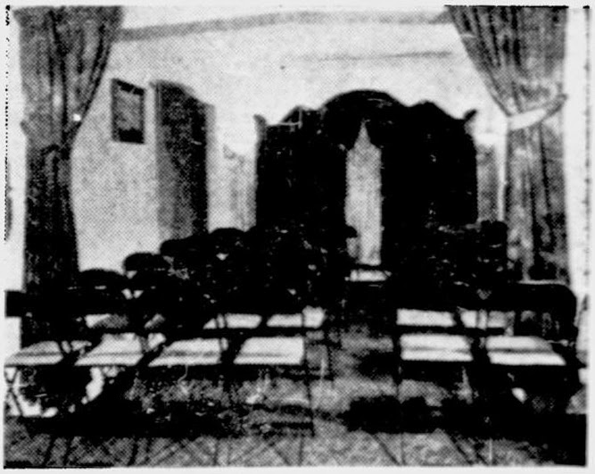
A view of the family reception room in the original funeral home at right.


The original funeral home chapel 1930-1947. (My apologies on the quality of some of these photos, they are taken from old photocopies and/or newspapers. I did the best I could with them). 


Ottawa Journal, February 10th 1940

At right is a vintage ad from the Ottawa Journal, promoting the range of affordability a Radmore Stewart funeral could offer. "$48 and less" sounds like quite a bargain, though I can't imagine what a less-than-$48 funeral would have gotten you!

For 17 years, the Radmore Stewart parlor operated in the small converted home (one of the sons and his wife even resided upstairs), before demand led to the construction of a new chapel addition, which opened in the summer of 1947. 


The new Radmore Stewart chapel, on July 18th, 1947
(click on this, or any photo, for an enlarged view)
(D00658 Sproul Collection - City of Ottawa Archives)


The inside of the new chapel in 1947


At left is a view of the interior of the Radmore Stewart chapel in 1947.

Radmore Stewart closed in late 1975 or early 1976. The location briefly became a Lebanese community centre, before the Sahara Dining Lounge opened in 1978. The restaurant did not last long, and it was taken over by the Church of God by 1981.

Meanwhile, next door at 1321 Wellington (the Bagelshop store portion) was built in 1945, and opened in April of that year as the new location of Armand Cloutier's local gift and variety shop (specializing in greeting cards, school textbooks and even radio repairs), having moved from 1244 Wellington (where Nectar Tea is now located). This shop would become a landmark of its own in West Wellington, remaining as Cloutier's until 1980. It briefly became the Wellington Travel Agency and Home Fashion Centre, before the Bagelshop opened in 1984.

And now you know the unique past life of part of the Bagelshop building!