(Again stepping outside the borders of Kitchissippi to research and write about a location that I've always been curious about. Hope you still enjoy! Grab a coffee and dig in...)
There is a piece of land that sits empty and unassuming, a rectangular block that comes to a triangular point, in one of the most prime areas of Ottawa. It has a consistently uncertain future, and a largely forgotten past. Everyone knows this spot, it's a location that we've gone past many times, probably hundreds or thousands if you were a regular commuter on the bus. Most have probably never given it too much of a thought, as it is just a vacant, dull and somewhat ugly space at the bottom of the old Nanny Goat Hill, cut off by the Slater Street ramp up the old, formerly-impassable hill.
At the south-eastern corner of LeBreton Flats stands a long stretch of Albert Street that was once a part of the bustling working-class community, but like the rest of the neighbourhood, was wiped out in the mid-1960s by the NCC under the promise of a major development, which 50+ years later we continue to await. (There is planned development of three condo buildings on this space, across from the new Central Ottawa Library).
For a little over 100 years, the south side of Albert Street on this stretch was home to hundreds of families in the 25+ houses that once stood here. Though the houses and businesses and people are long gone, their story still exists in the pages of old records and newspapers, and in old photos hidden deep in the vaults of the city archives. I was excited to try to bring some of these structures and individuals to life a little through an article on this blog, particularly as construction approaches on the library.
* * *
 |
| May 2019 - Google Streetview - looking east |
It's an intriguing parcel of land, grass-covered with the occasional scraggly tree or light post. Backing on to it is the retaining wall for the Slater Street ramp that climbs Nanny Goat Hill, which today one drives or walks up with ease to access the heart of downtown Ottawa, but for many years was a challenge to city traffic and road planners who had to circumvent the steep and dangerous hill to run traffic in and out of the city.
 |
| May 2019 - Google Streetview - view from the east |
Nanny Goat Hill
Some reading this article may never have heard of this name before, or perhaps have heard of it but have no clue to its origin. I grew up knowing the name well, as my grandmother spent some of her favourite years of her youth in her family home at the very top of the cliff, at the west end of Laurier Avenue. It's a bizarre name, one worth clustering with other oddly descriptive names Ottawa has such as Hog's Back, Startop Road or Mechanicsville. Sadly I think the name is mostly disappearing (Google brings up the results of the local community garden and a daycare, otherwise just a random scattering of old historical references). As the LeBreton redevelopment slowly moves ahead at a trickle pace, developers would do well to jump on this richly-historical name and incorporate in to the new neighbourhood being created. I hope they might!
The name originated back in the 19th century, and appears to have been an unofficial nickname given to the hill in the vicinity of Bronson and Laurier, which quickly turns in to the significant ridge/cliff that runs from Bronson all the way to about Booth in a southwesterly direction from where about Slater meets Bronson. This ridge is a primary reason that central Ottawa was spared from the Great Hull-Ottawa Fire of 1900, the fire which destroyed LeBreton Flats and Rochesterville on the Ontario side of the river.
 |
An early view from the top of Nanny Goat Hill, circa 1935?
(Source: LAC e10934966) |
Early references to the hill in local newspapers tend to all cite the same reason for the name - that it was so steep and so inaccessible to foot and vehicular traffic, that only goats could climb it. One or two sources note that the hill was inhabited by goats in the 19th century, and that well could be possible. Neither story is all that exciting, and despite some deep digging, if there is a more interesting origin to the name, I'm afraid it appears to be lost to history.
Regardless, Nanny Goat Hill was a pain to early Ottawa residents, and there was often talk of how to fix the issue, to open up access to downtown. I've included three old articles below that are pretty funny, about the early days of the Hill.
 |
| Ottawa Citizen, February 23, 1929 |
 |
| Citizen, October 11, 1922 |
 |
| Citizen, August 10, 1918 |
The LeBreton Flats Plan
The LeBreton Flats subdivision was laid out in August of 1845 by John LeBreton, who had acquired the lands back in 1820 in one of the most contentious real estate deals in Ottawa's history (even Eugene Melnyk would be jealous), a story which is well documented many times over, by historians who have studied the LeBreton history far deeper than I.
This was one of the first land subdivisions in the city - a fact reflected in the numbered plan at the Registry Office (it is Plan #2). With Bytown growing quickly, and mills arriving along the River particularly around the Chaudiere, the LeBreton Flats area was prime space for mill workers to build their homes. John LeBreton was 66 years old, and nearing the end of his life (he would pass away three years after laying out his plan). After offering for sale pieces of land from his holdings over the previous twenty years, this was a way of officially opening up Bytown to the west, and building the city further into Nepean Township.
His subdivision created various lettered blocks, and laid out streets and individual building lots. The Albert Street rectangle that this article focuses on was LeBreton's "Block N". A total of 12 lots, most roughly 66 feet wide by 99 feet deep.
"Block N" - the Albert Street triangle - early development
The LeBreton Flats lots hit the market 1845, but the lots didn't exactly sell like hotcakes. The plan contained hundreds of building lots, and the population of Bytown was still very small. The subdivision was registered with the knowledge that it would be a very slow growth; that it would be years and decades until the streets and neighbourhood LeBreton envisioned would exist in reality.
 |
1857 W.A. Austin Map of Carleton and Russell Counties
showing the LeBreton subdivision, and the lots on Albert,
with the Nanny Goat Hill/cliff illustrated. |
Lot 1
Just to get this out of the way first, Lot 1 from Block N is the bit of land to the east of Commissioner Street, separate from the rest of the Albert Street block. This land has it's own little unique history. It was the lot adjacent to Bronson Avenue which is now this triangular island that is tucked between the busy Bronson and Albert Streets, essentially best known for being where you loop around in order to drive south on Bronson today.
 |
May 2019 Google Streetview look at the triangular island
between Bronson, Albert and Commissioner Street. |
Believe it or not, this piece of land has it's own interesting story to tell, at one time featuring seven (!) small houses on it! The only visual evidence of this can be found on the 1878 fire insurance plan, which shows the 7 houses crammed onto this lot. See below:
 |
The 1878 Fire Plan showing Albert Street moving west from
the bottom right corner, and Commissioner Street moving
north from the bottom left corner. Bronson Avenue would
be along the bottom. Notice the unique house at the corner
(#506), a tiny triangle, just 1-storey high. How cool would
it be to find a photo of this little segment of old Ottawa! |
These poorly built houses only stood for roughly 20 years, from 1870 to 1890. No better example of the quality of build, and the rough lives lived by their inhabitants may be found than in this article from 1879 about Margaret Coughlan of 514 Albert Street, and the death of her infant son:
 |
| Citizen, January 20, 1879 |
After the houses were demolished the triangle would stand empty, as it continues to today, nearly 130 years later. For a brief period before WWI, it appears the city operated a small park space on the property, which in a few sources was called "Bronson Park", but by the 1920s the park was closed and the space never used. Old aerial photos seem to indicate a circular shape in the middle of the triangle, perhaps an old fountain or monument, but it is long gone.
Lots 2 to 12
Interestingly, three lots sold in Block N sold within the first month that they were available back in 1845. Lot 2 sold to Ralph Coy for 40 pounds, Lot 3 to Robert McGovern for 50 pounds, and Lot 4 to William Sweet for 60 pounds. (McGovern and Sweet would eventually default on the lots and they would return to the LeBreton estate soon after). In 1846, lot 12 at the western end of the block would sell to Lyman Perkins for the oddly low price of 1 pound, 5 shillings. In 1852, the LeBreton heirs sold a large number of the unsold lots in the LeBreton plan to John Woodill, and it was Woodill who would sell off the remaining lots of Block N between 1854 and 1862.
Reconstructing built history of the 1850s and 1860s is challenging, particularly as I've largely been used to researching Hintonburg and Westboro which didn't really develop until the end of the 19th century, when records and directories are far more complete. However from my research, I can conclude that the first house on this piece of land was constructed on lot 12 at the south-western end (the lot purchased by Lyman Perkins above), and was built by its new owner carpenter George Franklin, I believe sometime around the same time the map below was issued (1863).
 |
1863 Walling Map of Ottawa. This very early map is fantastic
in its detail of showing where all built houses exist (the black
dots represent structures). The Albert Street triangle is
shown with one house on its south-western end, built by
George Franklin that same year, 1863. |
The Franklin house was I believe 598 Albert Street, and it stood until the early 1950s.
 |
A small part of the amazing 1876 "Bird's Eye View of
Ottawa" poster. Christ Church Cathedral is at the left edge,
Concession is now Bronson, and the Albert Street block is
near the top right, below the Nanny Goat Hill ridge. |
The bulk of the construction on this part of Albert occurred between 1865-1875, by which time the street was almost completely built up to what it would ever be. The 1878 fire insurance plan below illustrates the houses and their locations at the time, on both side of Albert on this stretch. (Yellow indicates wood, grey is sheds/stables/garages, blue is stone, and pink is brick; the blue circles are fire hydrants; the little shaded space at the corner of Albert and Commissioner is piled lumber).
 |
1878 Fire Insurance Plan of Ottawa showing Albert Street
(odd shape due to it being pieced together from two different sheets) |
You can see that the block contains only wood-frame houses, largely small semi-detached houses, most of which have large sheds or stables in behind. The most unique addresses are those at the western end, where Albert and Laurier meet at a triangle. The original Franklin house is at 598, while other thin, odd-shaped units have been added on, with the addresses 602 and 606 Albert. (602 Albert would later be expanded to fill the little gap between it and 598).
Below is a list of all the residents in 1874 of the south side of Albert Street west of Bronson ("Concession line") to about Empress. A wide array of 1870's employments appear - blacksmiths, shoemakers, moulders tailors, carpenters, cabinetmakers, and more:
 |
Albert Street residents in the
1874 City Directory for Ottawa
(no house numbers included in
the Directory yet) |
Horse-drawn streetcars began running down this part of Albert Street in the 1880s, and the tracks remained here until the end of the streetcars in 1959. Some of the photos below show the tracks running on the street, though unfortunately I don't believe any of the shots I was able to find show a streetcar on them.
606 Albert Street
The corner building at 606 Albert was probably it's most interesting. It's earliest days were as a grocery shop operated by Mrs. Prodrick, which specialized in wedding cakes. It was Birtch Brothers Grocers in the 1890s, Abraham Stein's grocery store for 20 years in the early 1900s, Ahmed's Fruit Store in the 1930s, and Kay's Kosy Korner in the 1940s. It was demolished in the early 1950's when the Slater Street ramp was added. I would love to find a good quality photo of this old building, unfortunately none of my sources turned one up. The best I could do was a grainy shot from the Journal in 1951, when the Slater Street extension was being built (more on that below!)
 |
| December 6, 1951 |
A few ads and clippings from these interesting businesses of 606 Albert Street are shown below:
 |
| June 12 1875 |
 |
| January 26, 1927 |
 |
| March 23 1948 ad - why would you pick that acronym? |
526 Albert Street
At the opposite end of the street, the far east end, almost at Bronson Avenue, stood this cool old house, 526 Albert Street. The lot was acquired and a house built by Gordon Gilchrist, a machinist and millwright, sometime in the mid-1860s, and remained in the Gilchrist family for nearly 100 years! The Gilchrists also owned the semi-detached double in behind it, that fronted on to Commissioner Street (12 & 14 Commissioner). The Gilchrist family did briefly reside in 526 Albert in the 1800s, but for most of its lifetime, it was rented to tenants.
 |
526 Albert Street - January 1963
(City of Ottawa Archives, CA-26129) |
One of the most interesting tenants was a commercial operation, by Francis Wright, who operated a marble works and monuments business from the house in the 1870s and 1880s.
 |
| June 2 1879 |
The house was bricked sometime in the 1880s, and from the 1890s onwards appears to have been residential only.
552 Albert Street
This house was built around 1889-1890, and is interesting for the fact that for about 25-30 years, a major wood dealer operated out of the house and the then-huge vacant lot (wood yard) adjoining the house. John Marks was apparently a character of the neighbourhood. Born in Ireland, he had come to Canada in the 1870s and operated as a coachman in Ottawa, until acquiring the large lot on Albert for $900 in 1887 as a 47-year old, building the house and establishing his wood dealership business. The article below relates a funny story about Marks that was retold to the newspaper 20 years after his death.
 |
| February 27, 1932 |
The other houses of Albert Street
This article is already getting too long, so without getting into profiles of each individual house, I'll leave it to photos and newspaper ads to tell the story of some of the other houses of this classic stretch of Albert Street. Some of these photos were great rare finds in the City Archives:
570-572 was a great old double built around 1870, and which survived until about 1959, when the Urban Renewal Project saw to its demolition. Unique look for sure, and note the two children peeking out of the rear attached shed, beyond where an adult sits on the pile of old rocks.
 |
570-572 Albert Street - circa 1955
(City of Ottawa Archives, CA-26130) |
I believe the photo below is the rear view of 588 and 586 Albert Street (from left to right in the photo) as well as 584 Albert which is actually attached at the front part. All three addresses also fell victim to the Urban Renewal Project in the late 1950s, likely not long after this photo was taken. This photo is a great depiction of the dangers in housing in Ottawa, as additions of poor quality were added freely to houses, with little or no inspection or permit. The walls leaned, the roofs sagged, and there isn't a straight line to be found in any part of the structure. But people lived in these homes, that likely had minimal heating or insulation, and who knows what kind of water or sewage, for decades:
 |
586-588 Albert Street rear view March 1957
(City of Ottawa Archives, CA-26131) |
592-596 Albert is probably visually my favourite old house on the street. It is a beautiful old double, with the T-shape that came to the curb, but allowed for matching small front porches on either side. I guess the interior was in rough shape, as this house was one of the first victims of the Urban Renewal Project, demolished by 1955. In its early days (1870s) it would have been considered a prominent home, and was inhabited for several years by civil servant and former military man Capt. Horace G. Dunlevie.
 |
592-596 Albert Street - November 4 1953
(City of Ottawa Archives, CA-26132) |
 |
592-596 Albert (and a bit of 586 & 588) circa 1955
(City of Ottawa Archives, CA-26133) |
 |
Horace G Dunlevie in 1876
(Source: Topley Photo, LAC, MIKAN 3434977) |
Here are a few interesting miscellaneous ads and newspaper clippings that related to this strip of Albert Street:
 |
| February 27, 1895 |
 |
| May 22 1906 |
 |
| July 18, 1906 |
 |
| June 5, 1944 |
 |
| August 11, 1944 |
Miraculously saved from the Great Hull-Ottawa Fire of 1900
When I first set out to research this piece of land, I was sure that I'd be researching two sets of buildings: those that existed prior to the fire of 1900 and those that were built afterwards. However I was shocked to discover that this block somehow managed to avoid any loss from the fire! It fell just on the right side of the dividing line of complete destruction. It appears to have been a combination of factors that saved it from the flames. Notably the Journal wrote that the militia stationed in Ottawa, under the direction of Col. Cotton worked to save Ottawa at about this spot: "Col. Cotton says that nearly all the city militia turned out and nearly all the officers too. He said that the general opinion was that the men behaved splendidly and that they did much to save the town, especially around the foot of Albert Street, when the blaze was eating its way up to the heart of the city." The Journal also published a quote a day later from T.F. Kent of the American Bank Note Company who noted that "the work of Deputy (Fire) Chief Stanford and his mean near the corner of Hill and Albert Streets is specially worthy of commendation." Additionally, the proximity to the water works facilities just a block over was key, as "every available man in the corporation employ who could be got was at work trying to check the flames in the vicinity of the pump house and the press house." So it sounds like a good amount of the fire fighting efforts were concentrated all around this block of Albert Street, resulting in the entire block being saved!
 |
| 1900 Goad's Map showing an outline of the fire zone |
The Slater Street Extension/Ramp
Prior to the 1950s, Albert Street and Wellington Street were the only connection points to the west north of Somerset. Wellington crossed over the CPR trainyards at Bayview by way of a viaduct, and Somerset crossed the railway tracks via the Somerset Street bridge. Crossings at Gladstone and Carling also were options but essentially, most traffic went east along Wellington and forked at Albert. Commercial traffic and most cars stayed on Wellington, while streetcars and some local traffic took the Albert fork. The NCC and the City both wanted to get traffic off of Wellington, especially the larger commercial and industrial traffic away from the Parliament Buildings and National War Memorial, and to relieve the congestion at the Plaza bridge at Elgin. It was decided then, to establish a new east-west traffic route through downtown, and construct the MacKenzie King Bridge. As part of establishing this new route, planners needed to find a way to run the traffic in a more straight line into/out of downtown at the west, rather than require all traffic turn and divert at Bronson. Thus it was proposed to finally build a ramp up Nanny Goat Hill, and really establish Slater Street as a straight line through downtown at both ends (the new Nanny Goat Hill route to connect to the Wellington/Albert/Scott roadway) at the west, and the MacKenzie King Bridge at the east.
Running a road down Nanny Goat Hill or levelling it off somehow had been discussed on and off for decades, but it was the MacKenzie King Bridge construction that finally led to it getting done.
The agreement between the FDC (aka NCC) and the City originally stated that the FDC was responsible for acquiring the land for the necessary extensions for the MacKenzie King Bridges and approaches, while the City was responsible for the construction of the roadway and future maintenance. It appears that this changed, and the NCC eventually paid the full construction cost, with the City only contributing towards modifying city streets on approaches (particularly Nicholas and Waller). Work on the 1,900 foot long, 86 foot wide MacKenzie King Bridge began on May 25, 1950.
 |
| MacKenzie King Bridge under construction 1950 |
 |
MacKenzie King Bridge at opening
December 1951. No Rideau Centre
or DND's NDHQ yet! |
The new Nanny Goat Hill extension was not announced until March of 1951, and land acquisition took place in the Spring of 1951. The Bridge itself opened on the weekend of December 8-9 1951, while the Nanny Goat Hill portion was not opened until 1952. When it did open, Slater became a one-way street, as it is today, 67 years later. Albert also became a one-way street but only from Elgin to Bank. The total project cost $2,387,000, of which the City paid just $300,000.
Once the Bridge opened, attention turned to the new roadway up Nanny Goat Hill. The project required construction of a major retaining wall, and a lot of fill to help ease the steep grade. The total cost was $225,000. The new road opened August 15th 1952. Interestingly, the intersection at the top of the hill initially had a stop sign for Slater Street traffic only; Bronson traffic could go straight through.
 |
| Ottawa Journal - August 6, 1952 |
 |
| May 2019 Google Streetview of the same spot |
A few of the properties on the block of Albert Street were expropriated as part of the plan (lots 10, 11 and 12). I'm not sure why that was required, as the Slater ramp did not cut through the properties at all. Perhaps plans initially called for a potentially wider ramp, or perhaps the FDC simply felt that the homes at the western end of Albert would be in too-close proximity to the new roadway. Whatever the case, the brick triple at 584-586-588, the wood-frame double at 592-596 Albert, and old triple row-house at 598-600-606 Albert (including the block's first house, the Franklin built 1863 house at 598) were acquired by the FDC in April of 1951. The FDC chose to keep the brick triple, but demolished the rest sometime in 1952. As can be the case with expropriations, the land-owners did quite well in the transfer. The brick triple was owned by Patricia and Rose Sheen, who had bought it in September of 1948 for the reasonable price of $5,500. In April of 1951, they were paid $14,000 for it by the FDC.
The Expropriation/Disappearance of the community
The end of the LeBreton Flats neighbourhood was announced on April 19th, 1962, when the NCC announced its plans to redevelop the entirety of the community, and filed expropriation notices for all the properties within the 154 acres of land. Affected were the 2,800 residents of the neighbourhood, who occupied all of the homes, businesses and streets of LeBreton Flats, forced out as part of a grand scheme built around the construction of federal government office buildings on the space. The Journal wrote that day "This is urban renewal on the grand scale...for the entire area is one of rail yards, junk and scrap piles, garages, tractor-trailer sheds and largely down-at-the-heel row-housing. Plans for its transformation into a dazzling new annex to Parliament Hill and Wellington Street were blue-printed today by Works Minister Walker at a Centre Block press conference".
Of course we know how that turned out (as most of LeBreton sits still vacant today, with grandiose plans that never materialize offered up every few years).
Hardest hit by these plans of course were the residents, many of whom had lived in their homes for years, some for generations, and now suddenly no choice but to leave, and find a new home somewhere else. Though we have seen smaller examples of a significant displacement of residents (like the Heron Gate-Baycrest evictions last year), something on this scale will likely never been seen again. It would be like waking up one morning to hear that all of Westboro is going to be razed and all homeowners have to sell.
These homeowners received expropriation notices that were all mailed out on that fateful day in April 1962. Phil Jenkins describes the coldness best, as he wrote in "Acre of Time": "It went out en masse the day of the newspaper announcement; it laid out, without apology and in straightforward terms, how expropriation comes knocking at your door. After "Dear Sir or Madam" the opening sentence read: "This letter will advise you that on April 18, 1962, the National Capital Commission filed a Notice of Expropriation covering the property owned by you at [address]. This property is required as a site for government buildings and for the further development of the Ottawa River shoreline." Homeowners were told that solicitors would soon be visiting with more details. For now "It is important to realize that the Notice of Expropriation having been filed, title has automatically transferred to the National Capital Commission." This was to warn the owners that they might want to reconsider any improvements they had been planning. No point fiddling with the wallpaper when Rome was being demolished. The remainder of the notice contained information and advice from the commission. After the solicitors, it said, there would be appraisers, who would appreciate cooperation in deciding how much your home was worth. The commission wasn't going to come and get your house or business for two years, so you had lots of time to find somewhere else to live. If you had fire insurance, cancel it, because it wasn't your property any more. But go on paying your property taxes, and they'll be included in the eventual settlement. You can apply for an advance against settlement; pay off the debts on the property with it, then lease it back from us until you have moved away. Two weeks before you move away, give us written notice if you are a householder; a month if you are a business."
The initial plans for the expropriation interestingly did not include all of this block of Albert Street, but instead only included only the westerly 356 feet of frontage (half of which had already been acquired when the Slater Street ramp up Nanny Goat Hill was built). The rest would come in 1965.
Though being forced off your land via expropriation was awful for many of the families, the silver lining was that the payouts were quite generous. And the longer you held out, the more it appeared the landowners received. Most of the lots were being compensated in the $35,000-$40,000 range in 1966. Those who settled earlier received far less, for example Reuben and Alexander Cohen's lot 8 for $26,140, Patricia and Rose Sheen's lot 10 for $14,000 or Felippo Prosperine's lot 11 for $8,200 (the last two cases at least were in the first round of expropriations for the Slater ramp, but still, quite a significant difference).
The biggest beneficiaries? A pair, Cowley and Grant acquired lot 9 for $14,500 on April 12th, 1962 from the estate of Denis and Dora Charleobois, who had owned the lot since 1928. They flipped it to the NCC 15 months later in July 1963 for $31,950. Maybe the hardest to swallow in reviewing the records was the Gilchrist lot (lot 2). It left the Gilchrist family after 100 years in June 1961 when it was sold to Myers Ottawa Ltd. for $20,000. Myers flipped it to the NCC in 1965 for $31,500.
The whole LeBreton story could be told (and has been) via a book, so its hard to do it justice here, and I won't even try. And again, just trying to focus on this one part of Albert Street.
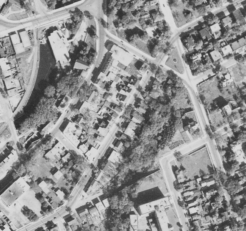
The fire insurance plans below tell the story of the final days of this area. In 1948 the houses were all still there, the Urban Renewal Project not yet started, the Slater Street ramp not yet constructed. But the 1956 plan and subsequent aerial photos show the gradual removal of the street over the next twenty years.
 |
| 1944 aerial photo |
 |
| 1948 fire insurance plan, pre-Slater ramp |
 |
| 1956 fire insurance plan, post-Slater ramp |
 |
| 1965 GeoOttawa - demolition well underway |
 |
| Ottawa Citizen - October 13, 1965 |
A few more photos!
Just a few more photos and clippings to complete the story. I attempted to do a few then vs. now photo comparisons as well! Enjoy...
 |
| 1912 Fire plan - showing density, at its classic etc |
 |
The corner where Albert and Slater meet, looking south.
July 9, 1954 (Ottawa Archives CA-4834) |
 |
The same view from 2017 Google Streetview
showing the Good Companions Centre |
* * *
 |
| 2017 Streetview - Commissioner at Albert looking south |
 |
Same view - September 19, 1955 Commissioner Street looking
south at Albert. That's 12&14 Commissioner in view, plus part
of 526 Albert (the Gilchrist house) visible at right. A cattle-
carrier truck ran into a streetcar (it was empty at the time).
(Ottawa Archives, CA-34349) |
 |
October 29, 1956 - same spot again. A man is being taken by
stretcher into the ambulance. I could not locate an article
in the same/next day's newspaper to find out what happened.
(Ottawa Archives, CA-41390) |
* * *
 |
The same intersection, but looking northwest (the tree and
two poles at left would be by where the damaged truck and car
are in the prior two photos). Good view down the north side
of Albert just a few years before it was cleared.
February 20, 1957 (Ottawa Archives - CA-43449) |
* * *
 |
December 6, 1951, a view of the Slater Street ramp
under construction |
 |
| same view 2019 |
* * *
 |
December 6, 1951 - a view west from Bronson at Slater,
with the new road under construction |
 |
| 2019 |
* * *
These last two photos mostly include only the opposite side of the street (the north side), but thought I'd include them anyways. Hey there's a couple of streetcars!
 |
| February 4, 1954 CA-3074 |
 |
| May 10 1954 CA-4186 |
The future of the block
The future of this block is certainly up in the air. Across the street, on the north side of Albert here will be the new Ottawa Central Library, a join project of the Ottawa Public Library and Library Archives Canada.
Also apparently in the works is potentially a change to the roads themselves, and a replacement of the old Slater Street ramp. Jon Willing of the Citizen reported in February of 2018 that : "The city wants to construct Slater Street west past Bronson Avenue in a straight line, getting rid of the ramp-like road up the escarpment from Albert Street and Empress Avenue. Emmanuelle van Rutten, director at the Moriyama & Teshima Architects’ Ottawa office, said the planners should be collaborating with the main library team to come up with a solution for the road junction. The importance of the intersection calls for its own design study, van Rutten said."
Hunting online for details of what is to come for this stretch of Albert, it is a bit uncertain and details are scattered.
An article on the Ontario Construction Report website from February 2019 included the following graphic, which appears to retain the original Slater Street route, and shows 4 condo buildings to be build on the Albert strip, with sizes of 6, 6, 4 and 6 stories respectively.
 |
| Source: Ontario Construction Report link |
While the Citizen included an article from 2018 that showed a 3D diagram of the area, bringing those 4 condos and the library to life a little:
 |
| Source: Ottawa Citizen link |
I didn't dig too deeply, I'm sure somewhere there are detailed plans for those buildings, but suffice to say, it looks like within the next 5-10 years, there will be activity once again on this block of land, for the first time in about sixty years.
---
I hope you enjoyed this in-depth look at this old block of properties from LeBreton Flats! It was a blast digging into an area that I don't typically research, and had a great time unearthing all these cool old photos!